
Identity area
Reference code
CR AN CR-AN-AH-MYP-020390-11
Title
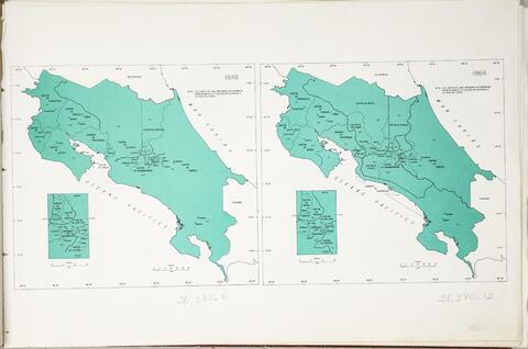
Mapa evolución de la división territorial administrativa de Costa Rica año de 1848, fijada en provincias, cantones y distritos, pueblos y una comarca. En Atlas Estadístico de Costa Rica Nº2. Realizado por: Dirección General de Estadística y Censos. Material: papel. Procedencia: Oficina de Planificación Nacional y Política Económica. 21x20 cm
Date(s)
- 1981-01-01 - 1981-12-31 (Creation)
Level of description
Item
Extent and medium
1 unidad, 153MB; Papel, Digital.
Context area
Name of creator
Biographical history
Repository
Archival history
Immediate source of acquisition or transfer
Content and structure area
Scope and content
Appraisal, destruction and scheduling
Accruals
System of arrangement
Conditions of access and use area
Conditions governing access
Conditions governing reproduction
Language of material
Script of material
Language and script notes
Physical characteristics and technical requirements
Finding aids
Allied materials area
Existence and location of originals
Existence and location of copies
Related units of description
Notes area
Note
Se le advierte que la fecha indicada es aproximada.