

Identity area
Reference code
CR-AN-AH-FO-251099-251113
Title
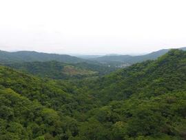
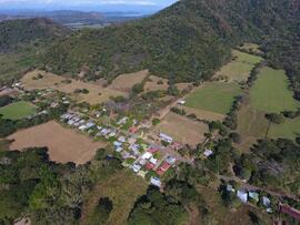
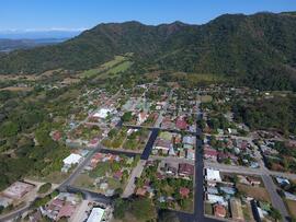
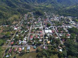
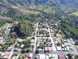
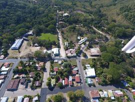
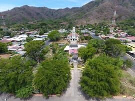
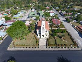
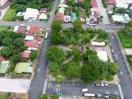
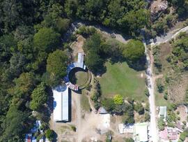
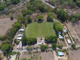
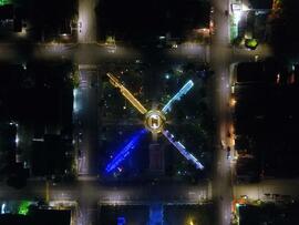
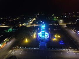
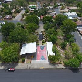
Fotografías aéreas del distrito Carmona en el cantón Nandayure, provincia de Guanacaste, al fondo se visualiza el Golfo de Nicoya. Se detalla imágenes de la Iglesia, el Kiosco y el parque central, el redondel de toros, campo ferial y plaza los Mangos.3 Ubicado en Latitud: 9°59′30.8″ Norte, Longitud:85°15′28.29″ Oeste Latitud/Longitud decimal: 9.99189°, -85.257859°
Date(s)
- 2017-01-30 - 2018-01-03 (Creation)
Level of description
Item
Extent and medium
3,22 MB; Digital
Context area
Name of creator
Administrative history
Archival history
Immediate source of acquisition or transfer
Transferencia T088-2023. Rescate
Content and structure area
Scope and content
Appraisal, destruction and scheduling
Accruals
System of arrangement
Conditions of access and use area
Conditions governing access
Conditions governing reproduction
Language of material
Script of material
Language and script notes
Physical characteristics and technical requirements
Finding aids
Allied materials area
Existence and location of originals
Existence and location of copies
Related units of description
Notes area
Note
Cantidad: 15 unidades
Note
Formato: JPG
Note
Dimensiones: 562 x 750 píxeles; 1000 x 750 píxeles
Note
Resolución: 96 ppp
Note
Escala de color: Color
Note
Disposición: Horizontal; Vertical
Note
La fotografías son complementarias a las signaturas R-AN-AH-FO-251096-251098 - Fotografías satelitales del Pueblo de Carmona
Alternative identifier(s)
Access points
Subject access points
Place access points
Name access points
Genre access points
Description control area
Description identifier
Institution identifier
Rules and/or conventions used
Status
Level of detail
Dates of creation revision deletion
2023-03-23
Language(s)
Script(s)
Sources
Archivist's note
Omar Rivera Fallas, Departamento Archivo Histórico